
Trace a Danvers Street by Address
For a street-by-street question, begin with a single Danvers address rather than a name. The public trail is strongest for parcels and recorded land. It is weaker for present occupants. An assessment card can provide the parcel, situs address, owner display, sale details, and a book and page reference. The GIS map adds the adjoining lots. The Registry then supplies dated instruments and the legal description that can keep the same land parcel connected when a number, subdivision, or street spelling changes. A local voter list or historic street list is a separate, time-bound source, not proof that every person at an address is still there.
- Enter the street name and number in Danvers Patriot Properties, then record the parcel, situs, owner display, sale data, and book/page.
- Open Danvers GIS and compare the target parcel with the lots sharing a boundary or frontage.
- Use the book/page, owner name, or address in the Essex South Registry search to inspect recorded conveyances.
- For a defined voter-record question, ask the Danvers Clerk for the lawful local record category. The state tool is individual confirmation, not a street roster.
- For an earlier household, ask the Danvers Archival Center about a street list, valuation list, or dated directory entry.
Keep an index citation with every result. The source title, date, and instrument role do more to prevent a mistaken match than a long list of unverified names.
Search Danvers Streets in Patriot
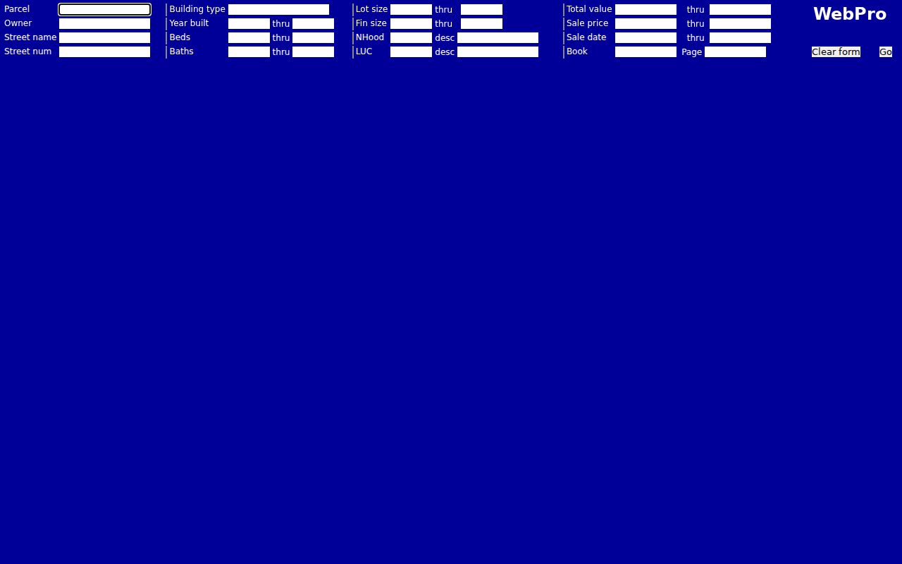
The Patriot Properties assessor portal is the main address-first starting point for a Danvers street directory search. Its form does not mark a field as required. Street name and street number can be used alone, or narrowed with parcel, owner, building type, local use code, neighborhood, value, sale date, and Registry book or page. Those filters describe assessment records. They should not be used to identify a household. A short search with the exact street name is usually safer than adding uncertain details that hide a matching parcel.
| Patriot field | How it works | Useful street task |
|---|---|---|
| Parcel | Optional parcel identifier | Reconnect a map result to its card |
| Owner | Optional name text | Find a known assessment owner |
| Street name and number | Optional text fields | Start or narrow an address result |
| Building type | Text and selector | Filter assessment class, not occupants |
| Year built, beds, baths | Optional numeric ranges | Distinguish similar parcels |
| Lot and finished size | Optional numeric ranges | Check the physical assessment profile |
| LUC and neighborhood | Local codes and selectors | Compare assessment categories |
| Value, sale date, sale price | Optional ranges | Locate a likely transaction period |
| Book and page | Optional Registry reference | Pivot from assessment to a deed |
The form provides Clear form and Go controls, with results loading in the portal frame. Official material did not establish an export rule, universal result cap, or definitive parcel-coverage statement. Treat the displayed card as an assessment lead and preserve the search date.
See the official Danvers assessor search before entering a street name.
Map Danvers Street Parcels
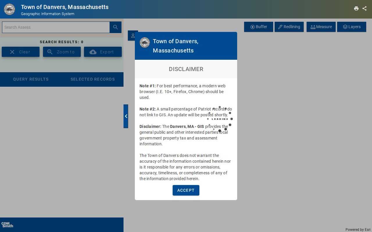
Danvers GIS, also called MUGIS, supplies the map context the assessor card lacks. Its public interface exposes parcel and address search, assessor detail, layer controls, measurement, selection, trace, redline, print, share, and adjacent-parcel style work. Start with the target parcel, turn on parcel lines, then inspect only nearby lots needed for the question. The map can compare frontage, plans, and planning context. It does not establish a legal boundary or a list of current residents.
The official zoning map cautions that GIS and planning content is informational and parcel lines are not legal boundaries. Dynamic inspection did not identify a fixed field list or exact label for an abutter, buffer, or radius action. Use the live map with care rather than assuming it creates a legal neighbor list.
Open the Danvers GIS viewer to see the parcel and layer tools in their current form.
Read Danvers Street Record Terms
Several address labels look alike but answer different questions. Keeping them separate prevents a common street-directory error: treating the person who receives an assessment bill as the person physically at the property. The Registry uses land descriptions and record roles, while the assessment card uses local parcel data. Old material can use a prior street name or number. Save all of those identifiers before deciding two records refer to the same place.
- Parcel or map-lot
- An assessment and GIS identifier that helps bridge a street address, subdivision, or map view. It is not a legal boundary by itself.
- Situs address
- The physical property location on an assessment record. It can differ from the address used for tax correspondence.
- Mailing address
- The destination for assessment mail. It may be outside Danvers and does not identify an occupant.
- Plat or plan
- A recorded map that can clarify lots, divisions, and boundaries when a street address changed.
- Criss-cross directory
- A reverse directory or street list arranged by address rather than name, for its stated year only.
Note: A street number by itself is weak historical evidence; pair it with a parcel, legal description, plan, or dated neighboring entry.
Follow Danvers Street Deed Records
The Essex South Registry of Deeds provides the legal-record leg of a Danvers street search. Its recorded-land address form asks for a street name and date range, with Danvers selected from the city or town menu and document types available for filtering. Enter a street without a suffix such as Street or Avenue. For a range or suffix, use the first number. The address route begins May 31, 1899 and covers deeds and conveyance documents, so a missed record may require a name, book/page, plan, or older-index search.
Record the grantor, grantee, recording date, document type, book/page or instrument number, town, street address, and image availability. Then open the deed image when possible. An image can supply the legal description, prior references, easements, restrictions, or trustee language that the index line cannot. The Registry says its certificates may not contain complete information, and image access or download can require payment. A full title conclusion belongs with written Registry records, not an assessor display.
Use the Essex South recorded-land address search when the street is known.
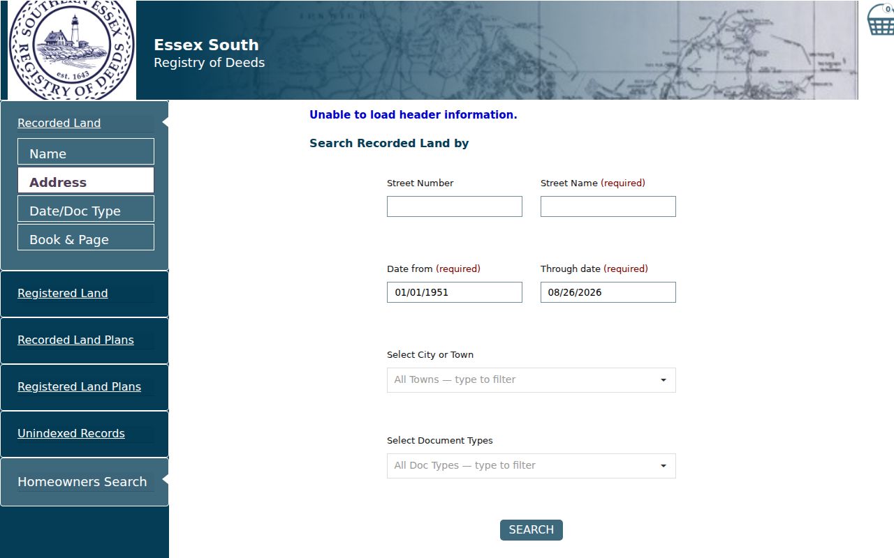
The Registry home and additional search routes also offer name, date/document type, book/page, registered-land, plan, and older-index options. They matter when the address result is too recent or uses an earlier spelling.
Compare Danvers Records by Address
No one source is a complete Danvers street directory. The coverage below separates what each address-keyed record can establish from what it cannot. The assessor and GIS pair offer a current parcel view. Registry documents give a dated ownership and land-description trail. Historical sources can document a past connection. Permit and code materials must be requested or located case by case because the research did not find a complete public address-wide index for Danvers.
| Address record | Keeper | Street evidence | Access route |
|---|---|---|---|
| Assessment card | Danvers Assessing / Patriot | Parcel, owner display, situs, building, value, sale, book/page | Public portal |
| GIS parcel layers | Danvers GIS | Geometry, adjacent parcels, layers, measurements | Public informational map |
| Recorded deeds and plans | Essex South Registry | Parties, dates, instruments, legal descriptions, restrictions | Free index; image access may cost |
| Local voter record | Danvers Town Clerk | Defined local public voter categories, subject to exclusions | Clerk request, not a statewide street download |
| Building, health, or fire permit | Town permitting offices | Premises, category, date, applicant or owner when public | Town links or a defined request |
| Street list or directory | Archival Center / libraries | Historic address-to-person evidence for its year | Collection inquiry or on-site research |
| Sanborn map | State Library / LOC | Structure, footprint, use, and street context | Historical map collection |
A public-records request can be written, emailed, mailed, or made in person through the Town Clerk, the Records Access Officer. Name the record category, address, date range, preferred format, and a contact method. The Town need not create a new street list by compiling unrelated records.
Use Danvers Street Lists and Maps
For earlier households, the Danvers Archival Center is the practical local handoff. Its holdings include street lists, valuation lists, annual reports, printed and manuscript vital records, family collections, organization records, and newspapers. Street lists survive for 1938, 1959, 1966, 1975, 1982, and 1992. Valuation lists are identified for 1875, 1941, 1950, and 1952. These are dated sources, so they can place a person or property relationship in a period without being recast as a current address record.
Sanborn maps complement the written material. The State Library list identifies Danvers sheets for 1887, 1892, 1897, 1903, 1909, 1916, 1927, 1927 to 1948, and 1961. They show building footprints, construction or use context, and numbered-street clues, not occupants. The historical volumes are covered in the Danvers City Directory, which focuses on reading and comparing directory entries.
Call the Archival Center before an in-person visit if a street list, house file, local photograph, or organization record is needed. A request with a street, approximate year, and record category gives the archivist a usable starting point.
Match Danvers Street Names by Era
Old address material can use a different place name even when the land lies near modern Danvers. The local chronology runs from Salem Village, to a separate parish in 1672, to the Danvers district in 1752 and town in 1757. The Middle Precinct area later became Peabody after its 1855 separation and 1868 name change. A source labeled Salem Village, South Danvers, Danvers District, or Peabody should be read in its date and jurisdiction rather than forced into a modern address label.
No official Danvers street-renumbering or renaming project, date, or conversion record was located. When an older street name does not match, compare the legal description, parcel or map-lot, subdivision plan, nearby institutions, directory neighbors, Sanborn footprint, and grantor or grantee. Mark the bridge as probable until two independent dated records agree.
Note: The Registry's main recorded-land index begins in 1951, but recorded images reach back to 1640 and older index ranges are separately organized.
Check Danvers Address Permit Trails
Address research can also reach the Town's permitting channels. The Permits and Payments page links building, engineering, fire, and health routes, while the Permitting page lists food, mobile-food, animal, and funeral categories. A permit may name a premises, applicant, owner, category, or date. It does not necessarily identify a resident, and it should never be treated as a household list.
The official sources did not locate a complete downloadable building-permit history or a public code-enforcement search keyed to every Danvers address. For a specific record, use the appropriate Town link or make a narrow public-records request. Ask for the premises, date range, and record category, then retain any redaction, fee estimate, or custodian referral with the response.
Respect Danvers Street Directory Limits
A parcel is not an occupant list. Assessment and deed records may omit people who live at an address, while the listed owner may receive mail elsewhere. A voter record has controlled public fields, and the statewide tool confirms one person rather than producing a block file. Utility and delivery customer data are not public. Massachusetts voter guidance excludes phone, email, veteran, permanent-absentee, and confidential-voter information. Court and vital-record restrictions add other limits.
When the question is about a property boundary, easement, or ownership chain, return to the Registry and written records. When it is about a current person, use the smallest necessary fact, record the source date, and avoid turning a partial match into a conclusion.